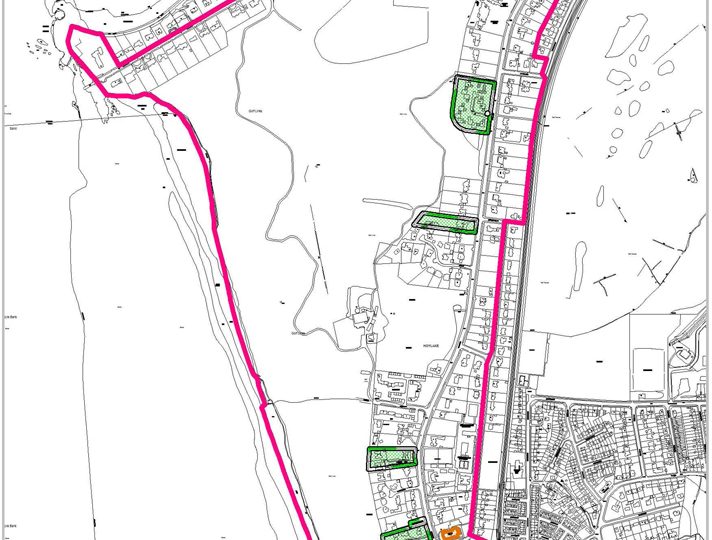
This important conservation area (CA) encompasses two formerly separate areas – The Kings Gap-Stanley Road CA and the Meols Drive CA. As the two areas shared a common boundary and had identical aims, responsibility on behalf of local residents for the administration of both was unified in early September 2010 having been approved by local residents at two public meetings.
For ease of reference, Wirral Borough Council has agreed in principle that the new name of the Hoylake Conservation Areas (HCA) would be simpler, more sensible and appropriate. The boundaries of the HCA remain unchanged from those of its forerunners but because of the overlap, it seemed sensible and practical to unify the residents’ interests and responsibilities under one committee.
Sometime later, in February 2004, a second area called the Meols Drive CA was designated in order to preserve the unique buildings, visual amenity and open space which made up the surrounds of the Royal Liverpool Golf Club. In particular, the fine examples of Victorian and Edwardian housing and its spacious tree-lined character was worthy of preservation. Meols Drive also provides an element of separation between the two urban centres of Hoylake and West Kirby. The chosen boundary extended from Lingdale Road to the south, along Meols Drive to the Kings Gap and also includes The Quadrant and Stanley Road. Listed buildings are: St Andrew’s Church, the Evangelical Church at the corner of Station Road/Meols Drive and the Hoylake Railway Station and shops. The Royal Liverpool golf course and its grand and historic Club House are important historically and physically and are dominant features in the surrounding landscape. Also of interest is the Church of Christ Scientist in the King’s Gap which is of contemporary and unique design. It represents an example of modern design of good quality which can be considered an acceptable example of later development.
Council Responsibilities
The designation as a CA indicates Wirral Borough Council’s positive commitment to conservation and their intention to preserve and enhance the quality of the environment within it and in its near vicinity. This is embodied in Policy CH2 which governs development affecting Conservation Areas. Specifically:
- CA consent is required for the demolition of all unlisted buildings in the area
- Planning applications for development which would, in the opinion of the Local Planning Authority, affect the character or appearance of the CA must be given publicity and representations received as a result must be taken into account in determining the application
- The Local Authority (Wirral Borough Council) is under duty to pay special attention to the desirability of preserving or enhancing the character or appearance of the area under the Planning Acts and Part 1 of the Historic Buildings and Ancient Monuments Act 1953
- It is an offence, subject to certain exceptions, to cut down, top, lop, uproot, wilfully damage or destroy any tree in the area except with the consent of the Local Planning Authority
- Permitted development rights within a CA are more restricted than in other areas
- Wirral Borough Council is under a duty to formulate and publish proposals for the preservation and enhancement of the area
More detailed maps showing the exact boundaries of the HCA and the respective appraisals are on Wirral Borough Council’s website


